

I hiked Old Mount Baldy (near Shawnigan Lake) recently with three main goals in mind:
- 1: Get a good workout
- 2: Take in some incredible views
- 3: Take some pictures at the Instragrammable swing at the top
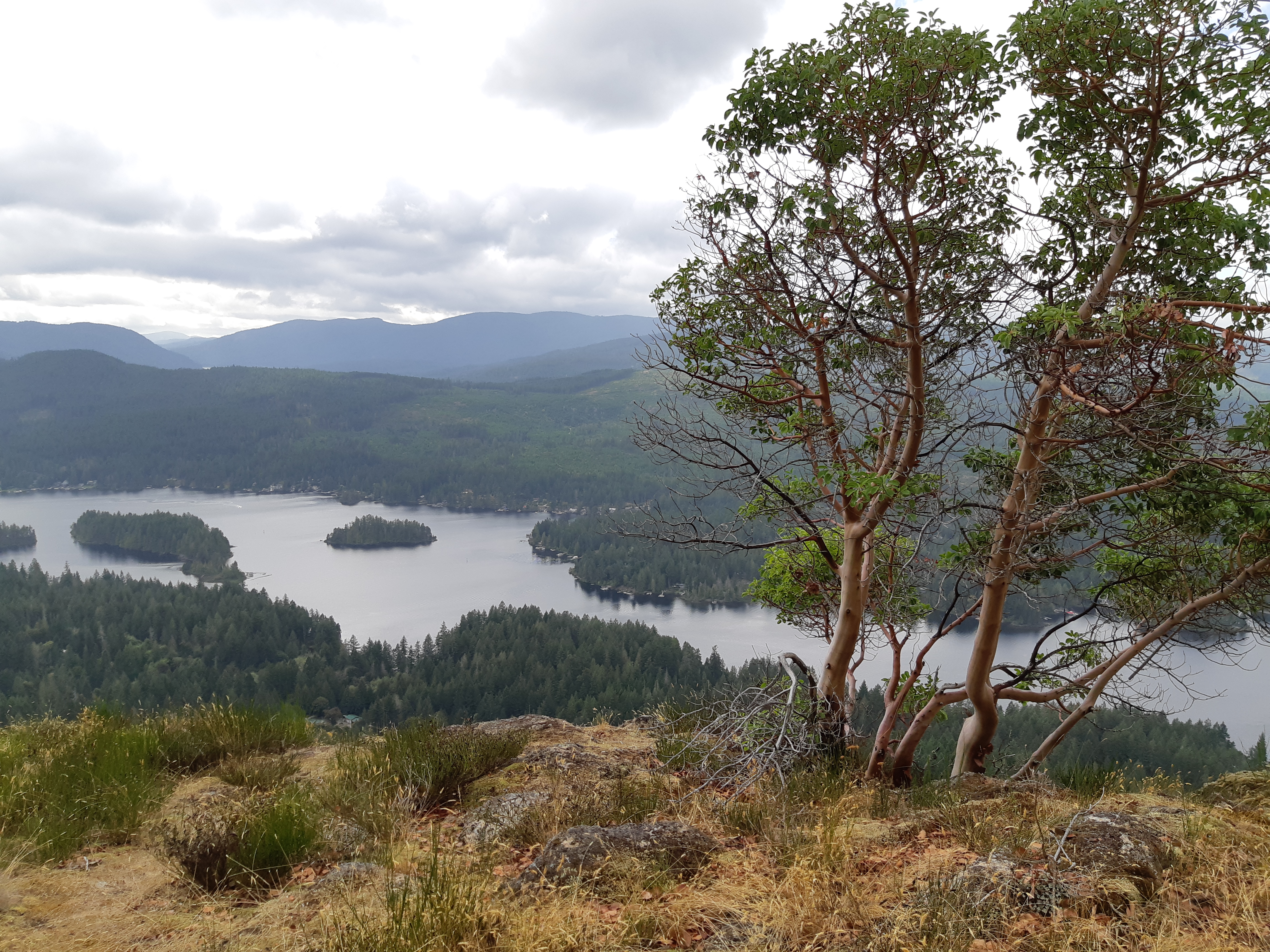
Goals 1 and 2 were easy to accomplish; the hike isn’t too long but it’s steep with some scrambly bits, so the 360 degree views at the summit of Shawnigan Lake and the islands in the Straight of Georgia are definitely well-earned! As for the swing… it was hard to find.
You’d think it would be obvious once you get to the top, but the summit is pretty open and rocky, and at first glance there’s nothing hanging on the arbutus trees nearby. I knew from the pictures I’d seen on Instagram that the the swing faced out over Shawnigan Lake, and that turned out to be helpful. If you keep walking a little further with the lake on your right, you’ll get to a viewpoint with some rock piles nearby (just a minute or two past the summit). Just beyond that is the swing, so if you keep walking along the path through the trees, you’ll find it!
The swing offers some great photo ops, and it’s definitely a fun way to check out Shawnigan Lake from above!
Looking for more info about hiking Old Mt. Baldy? Keep reading! For more info about what to do in the Shawnigan Lake/Cowichan Valley area, check out this post.
To get to the trailhead: We followed our Google Maps directions to a spot on Strathcona Heights Rd across from a yellow gate, which is where you’ll start. It sounds like there’s also another trail that starts at a red gate, not quite as far down the road. If you start at one and end up at the other, you could always hike back along the road.
The first section is up a steep gravel service road, but once you get to the first of many sweeping views over Shawnigan Lake, it becomes more of a trail over rocks and through arbutus trees. There are some areas where you’ll need to scramble over rocks and grab onto roots to get up. I found it harder going down; there was one spot where I was fully on my bum to slide down a steep section of dirt. We saw kids on the trail too; it’s not that it was super challenging (remember, we’re fairweather, average shape, occasional hikers here), but I did have to use my hands (and my bum) more than anticipated! The views are just fabulous; Shawnigan Lake on one side, and once you get to the summit, Saanich Peninsula, the Gulf Islands on the other.
According to my Strava app, our hike was 1.22 km up, 179 m elevation, and just about 30 minutes to the top with some photo stops. Going down only took 18 minutes.

1 Pingback